Cities in Action – Transitions Toward Climate Neutrality
On 12th December 2025 Louise posted in Events, News, Projects, Uncategorised
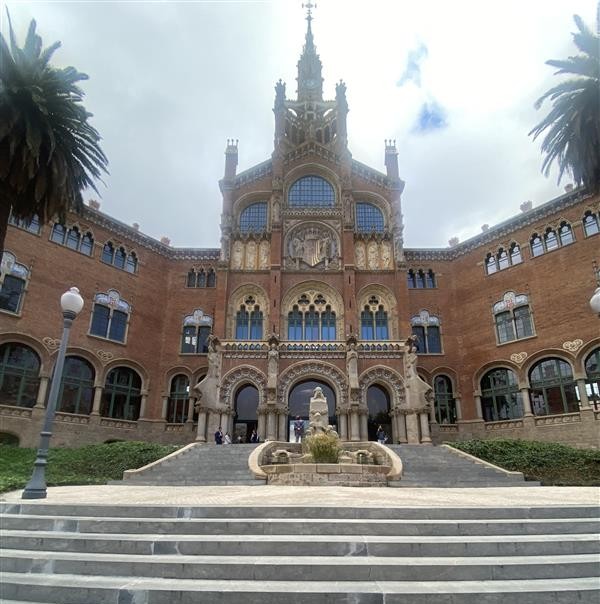
On 3 November 2025, we had the privilege of attending the Cities in Action conference in Barcelona, hosted by the UP2030 Horizon Europe project. This event brought together cities, tool providers, and experts committed to driving socio-technical transitions toward climate neutrality.
Continue reading…Building Belfast’s Net Zero Future – One Neighbourhood at a Time
On 30th July 2025 Amanda Newton posted in Events, Featured, News, Projects
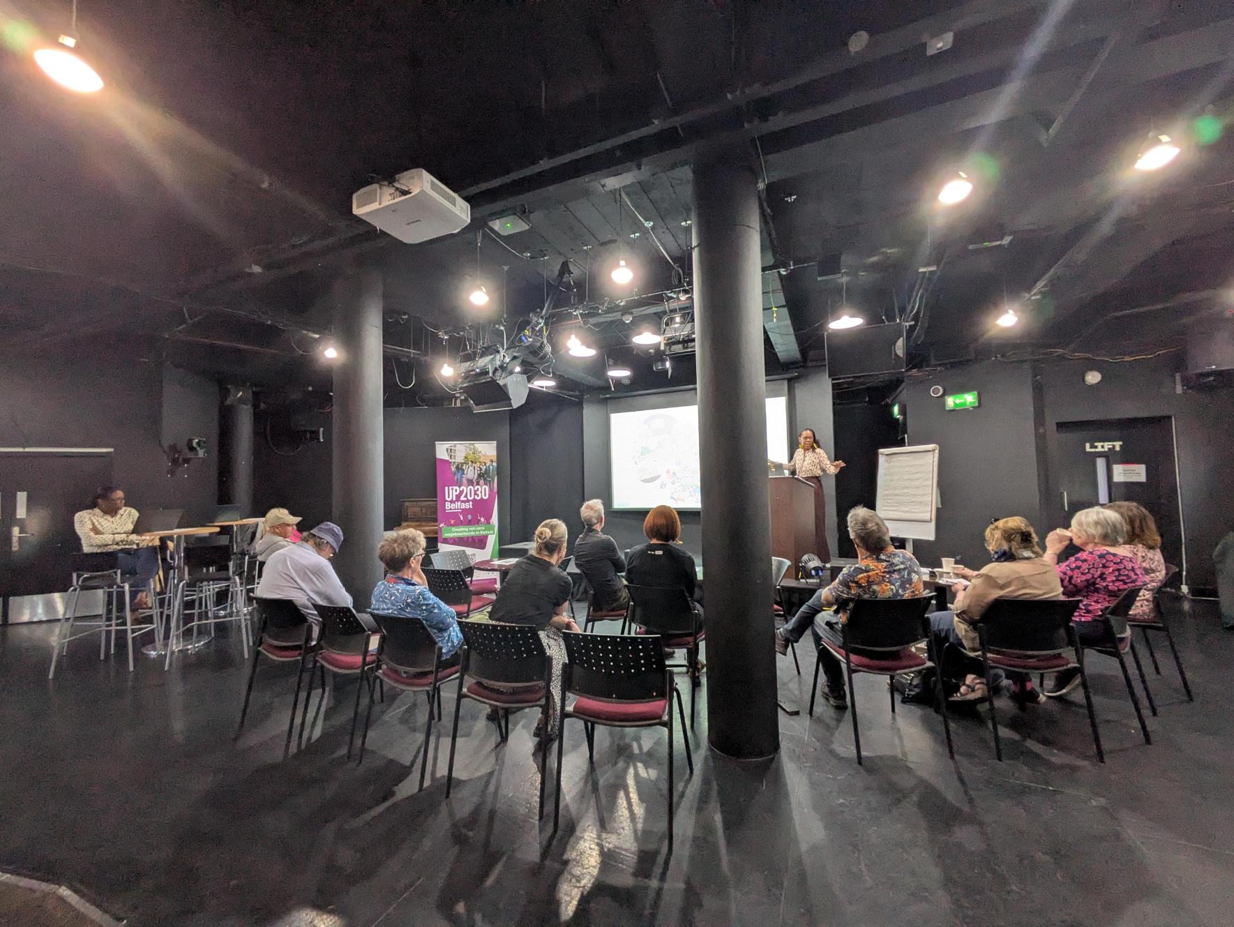
As part of the UP2030 project two ‘Community Sense Checking Workshops‘ were held in May 2025 to hear directly from residents in areas like the Market and Donegall Pass. These sessions explored what a Net-Zero Neighbourhood could look like and how we can get there together.
🌿 Empowering Citizen Voices in Budapest’s Greening Strategy 🌿
On 10th July 2025 Louise posted in Featured, News, Projects
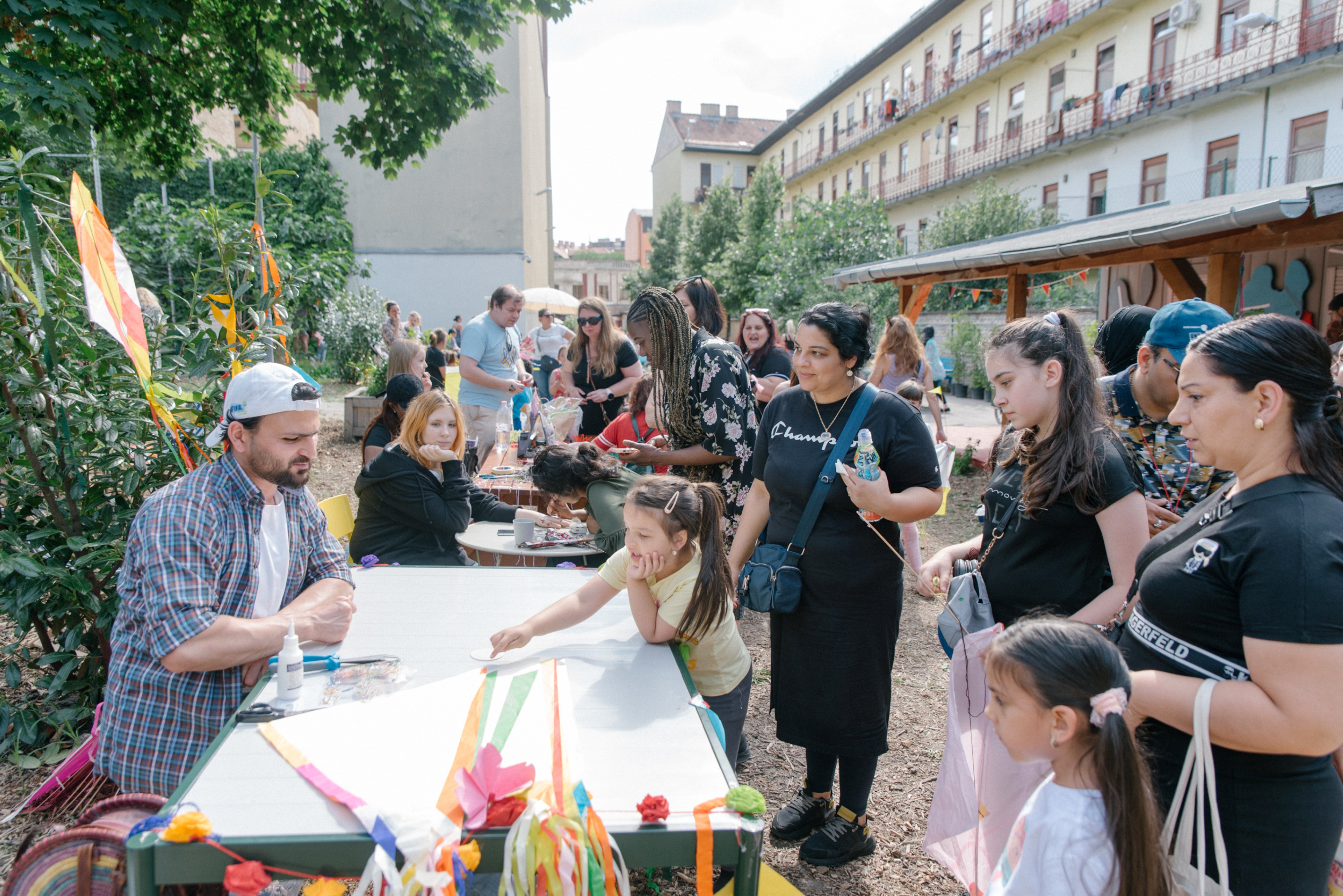
Mapping for Change has been working with Budapest City Council and GGGI Hungary as part of the EU-funded UP2030 project to strengthen public engagement in planning and decision-making around green infrastructure improvements.
Continue reading…Thank You, UCL, for Supporting Innovation and Social Enterprise!
On 31st January 2025 Amanda Newton posted in Featured, News
We are thrilled to be featured among the 10 innovative startups in TechRound’s recent article, being recognised alongside such a dynamic group of companies is truly an honor.
UP2030 Belfast Retrofit Workshop
On 18th September 2024 Amanda Newton posted in Events, Projects
In June, the UP2030 Belfast Retrofit Workshop brought together key stakeholders to focus on strategies for retrofitting Belfast’s residential, commercial, and public buildings.
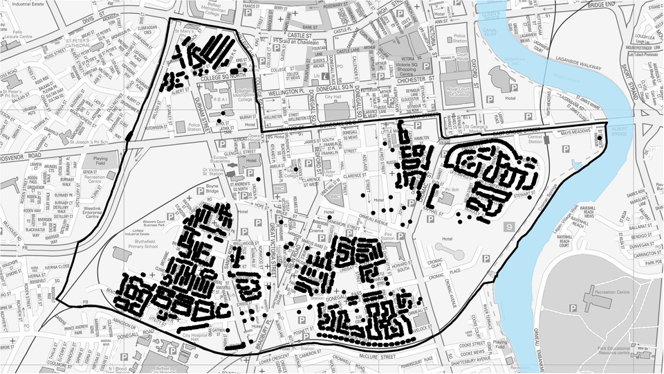
The aim was to align efforts toward making the city’s buildings more energy-efficient and climate-resilient, with the ultimate goal of creating Belfast’s first net-zero neighbourhood.
Continue reading…We Care for Our Air: Project Update
On 13th September 2024 Amanda Newton posted in News, Projects
Air pollution remains a significant concern, affecting communities nationwide, including Redbridge. In response, Redbridge Council has been driving a comprehensive program aimed at monitoring, raising awareness, and ultimately reducing air pollution in the borough. The “We Care for Our Air” initiative, running until March 2025, is a critical part of this effort, consisting of a series of initiatives designed to tackle air pollution head-on.
Continue reading…Brr-eathe Easy: We Care for Our Air Winter Update
On 19th January 2024 Karissa Johnson posted in News, Projects
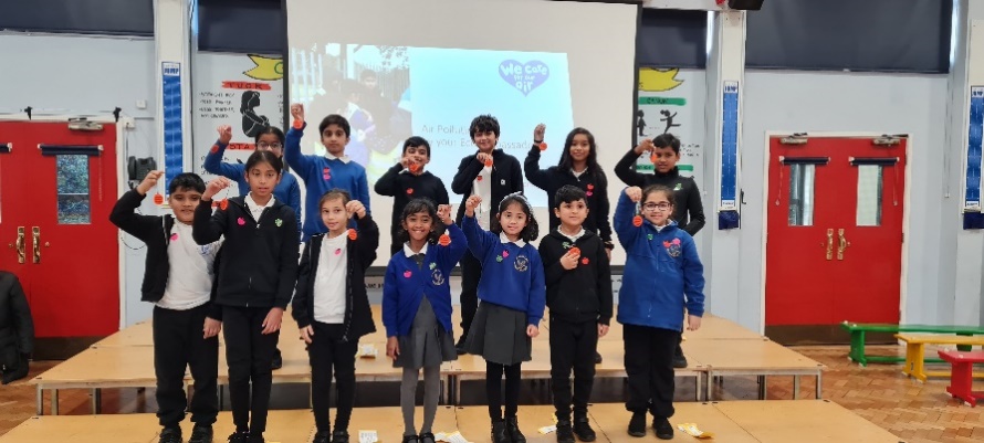
It has been a bustling winter so far for the We Care for Our Air project, entering the new year with a lot of momentum.
Three months of diffusion tube data have now been plotted onto Redbridge’s borough Air Quality Map, thanks to the 78 residents and organisations helping to monitor air pollution at places they care about, including Cllr Sunny Brar of Newbury Ward.
Continue reading…Redbridge Cares for their Air Quality
On 26th September 2023 Karissa Johnson posted in News, Projects
It’s been six months since the launch of We Care for Our Air Redbridge, a project aimed at understanding air quality in the borough. During this time, the community has come together to make commitments to support cleaner air.
We Care for our Air Redbridge has two strands to tackle the issue of air pollution head-on. Firstly, is our citizen-led data collection effort using NO2 diffusion tubes and hand-held particulate monitors. The second part of our mission is all about raising awareness and educating the community about the risks of air pollution. We focus on what actions each person can take to avoid pollution and improve the air in Redbridge.
Continue reading…Digital tools to support Climate Smart Agriculture in Nigeria
On 9th September 2021 Maria posted in Projects
In Nigeria, 70% of the population are involved in agriculture at a subsistence level. Most of their farming systems follow traditional methods, such as slash and burn, and are increasing their chemical dependence. These elements are key drivers of rising deforestation, land degradation and ecosystem loss, among others. In addition, the impact of climate variability has altered Nigeria’s rainfall and temperature regimes over the past decade.
Continue reading…Science in the City Returns…
On 17th August 2021 Hannah posted in News, Projects, Uncategorised
What impact has the air pollution reduction measures introduced by the City of London Corporation over the past six years had? That’s what we’re aiming to find out! Levels of particulate matter and nitrogen dioxide can be a concern in urban areas. Both air pollutants are associated with fuel combustion; transport and heating.
Continue reading…