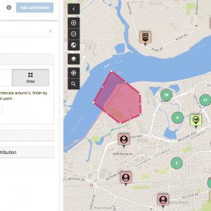
The UK Climate Action Map, a new interactive resource, is now on-line and under development. We have set this up for the Communities and Climate Action Alliance and it is being taken forward with the Low Carbon Communities Network. The map can be seen at www.communitymaps.org.uk/ukclimateaction.
In 2009/10 we worked with the Green Alliance, funded by the Gulbenkian Foundation, to map local activity on climate change in two areas of the UK – rural north Dorset and inner-city Newcastle upon Tyne. These are on our Maps site. This work was done in partnership with local networks and focused on voluntary and community activity, but as the maps develop public and private sector activities have been added. The two maps share some common layers (such as local energy projects) while extra layers were added during the workshop processes.
The UK Climate Action Map was developed as part of the resources to support the Communities and Climate Conference. It has drawn on data for climate maps in Dorset, Newcastle and London, as well as those who attended the conference. Since then it has been further promoted and about 4 new projects a week are adding themselves (each entry is moderated by MfC before it appears on the map).
We are now starting to redevelop the map. Coming months will see increased functionality (this would include the ability to lay other data (e.g. ONS information) over the map, and this week the ability to embed videos is being built in. If you’d like to be involved in this project or know more please do get in touch.
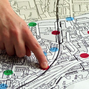
Maps
Maps can show you where you are. But a good map can also show you where you want to go, and how to get there.
With a map, you can communicate, analyse and enact change. We work with communities to achieve social and environmental change in their local area.
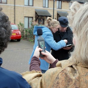
Citizen Science
Environmental problems affect us all. Citizen Science can give you a voice. Let’s collect the data we need to raise awareness and fight for change.
Low tech and affordable methods mean that everyone within a community can get involved and become a citizen scientist.
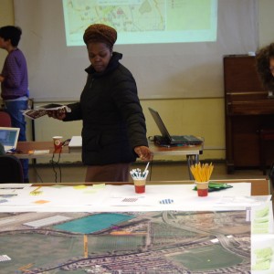
Community Engagement
Does your organisation work with community groups? We can design and implement a unique engagement approach, tailored to your particular requirements.
With over 15 years experience in the community and voluntary sector, we understand how to reach and involve people.
Map Visualisation & Analysis
Space is complicated. Map visualisation & analysis can help you to understand and discover what’s going on.
We have expertise in the use of Geographical Information Systems, and we can apply it to meet your needs.
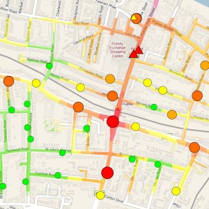
Online Mapping Platforms
It’s good to collaborate. Contribute, share and discuss your ideas about the places that matter with Community Maps, our online participatory mapping platform.
Community Maps provides an effective tool for community and multi-stakeholder consultation across a range of projects and sectors.